Fari Kandu Huraa
Tourism Island - Resort
Code: K
About Fari Kandu Huraa
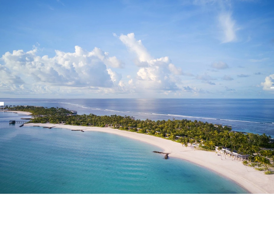
Fari Kandu Huraa sits beside one of Kaafu Atoll’s key channels, where nutrient-rich waters support manta rays, reef sharks, and large schools of fish. Gently sloping beaches lead into turquoise lagoons perfect for swimming. Historically, the island was part of a coconut cultivation network. Divers flock to nearby Fari Kandu for drift dives with strong currents and abundant marine life. Coral restoration projects are underway to rebuild branching coral colonies affected by bleaching. With minimal infrastructure, the island retains a natural, untouched feel, making it appealing for nature lovers and underwater explorers seeking less-crowded marine habitats.
Island Information
Administrative
- Island Name
- Fari Kandu Huraa
- Island Code
- K
- Atoll
- Male' Atoll
- Island Type
- Tourism Island - Resort
- Regulating Authority
- Ministry of Tourism & Environment
- Primary Agency
- Ministry of Agriculture & animal welfare
Stay in Fari Kandu Huraa
Discover the perfect establishment for your island getaway
The Ritz Carlton Maldives Fari Islands
Fari Kandu Huraa, Male' Atoll
232 beds
116 rooms
Fari Kandu Huraa lies within the lagoon system of Kaafu Atoll where coral islands rest on shallow reef platforms. The island developed through coral sand accumulation along the reef crest. Historically islands in this area were visited occasionally by fishing communities from nearby inhabited islands. The surrounding lagoon waters and reef slopes remain central to the island’s marine environment.
Quick Stats
- Sites
- 0
- Zones
- 0
- Plots
- 0
- Accommodations
- 1
- Total Beds
- 232
- Total Rooms
- 116