Muli
Residential Island
Code: M
About Muli
Muli, the administrative capital of Meemu Atoll, is a compact yet vital island measuring about 1.5 km in length and 0.6 km in width. Fringed by white sandy beaches and a shallow turquoise lagoon, it is surrounded by coral reefs alive with reef fish, colourful corals, and seasonal manta ray visits. The coastline is shaded by coconut palms and breadfruit trees, reflecting a long tradition of island self-sufficiency. Historically, Muli served as a hub for atoll governance, fishing, and boatbuilding, its sheltered harbour connecting neighbouring islands for trade and travel.
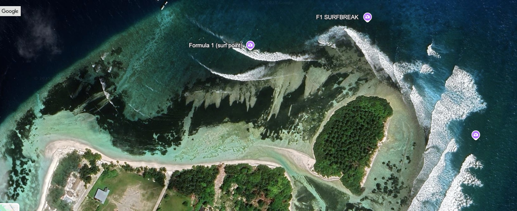
Today, Muli is gaining attention as one of the Maldives’ emerging surfing destinations. Its renowned right-hand reef break delivers consistent, clean waves—ranging from fast barrels to long, playful rides—especially during the southwest monsoon from May to October. This draw for surfers sits alongside exceptional snorkelling and diving in nearby untouched reefs. With the recent opening of Muli Airport, reaching this blend of wave-riding excitement, vibrant marine life, and rich cultural heritage has never been easier. Unique among capital islands, Muli balances its administrative role with a sense of natural tranquillity, offering visitors an authentic Maldivian experience on land and sea.
Today, Muli is gaining attention as one of the Maldives’ emerging surfing destinations. Its renowned right-hand reef break delivers consistent, clean waves—ranging from fast barrels to long, playful rides—especially during the southwest monsoon from May to October. This draw for surfers sits alongside exceptional snorkelling and diving in nearby untouched reefs. With the recent opening of Muli Airport, reaching this blend of wave-riding excitement, vibrant marine life, and rich cultural heritage has never been easier. Unique among capital islands, Muli balances its administrative role with a sense of natural tranquillity, offering visitors an authentic Maldivian experience on land and sea.
Island Information
Administrative
- Island Name
- Muli
- Island Code
- M
- Atoll
- Mulakatholhu
- Island Type
- Residential Island
- Regulating Authority
- Council
- Primary Agency
- Council
Additional Information
Reef System: Muli’s fringing reef supports high coral diversity, with branching and table corals providing habitat for reef fish, sea turtles, and occasional manta rays.
Lagoon Ecology: The shallow lagoon serves as a nursery for juvenile fish and invertebrates, making it important for atoll-wide fisheries sustainability.
Wave Formation: The island’s southern reef edge naturally channels ocean swells into a right-hand surf break, a feature shaped by reef slope, channel depth, and seasonal currents.
Coastal Vegetation: Includes coconut palms, breadfruit, sea lettuce trees, and beach morning glory, stabilising the shoreline and providing resources for the community.
Historical Use: Traditionally a centre for fishing and boatbuilding, Muli’s harbour linked surrounding islands in both calm and storm seasons.
Environmental Pressures: Coastal erosion on windward shores and increased waste challenges with rising population and transport links.
Quick Stats
- Sites
- 0
- Zones
- 0
- Plots
- 0