Finey
About Finey
Island Information
Geographic
- Area
- 117.30 hectares
- Nearest Island
- Theefaridhoo (2.32 km)
Coordinates: 6.746074, 73.053514
Administrative
- Island Name
- Finey
- Island Code
- HDh
- Atoll
- South Thiladhunmathi
- Island Type
- Residential Island
- Regulating Authority
- Finey Council
- Primary Agency
- Council
Additional Information
Phone: +960 652-0027
Email: info@finey.gov.mv
Environmental Sites
Documented ecosystems and environmental sites on Finey.
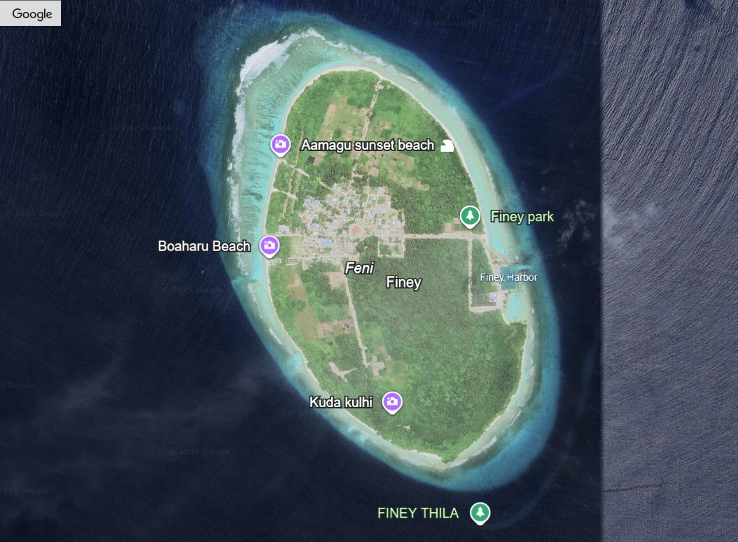
Finey Thila
DocumentedMarine Protected Area (MPA)
Finey Thila is a Marine Protected Area (MPA) located near Finey Island in Haa Dhaalu Atoll, classified as Category 7: Protected Area with Sustainable Use since 17 June 2019 (ENV/438/2019). Covering 97.49 hectares, the thila is a submerged reef pinnacle rich in soft corals, reef fish, and other marine life that support traditional fishing practiced by the local community. The reef’s structure provides natural shelter for juvenile fish and invertebrates, contributing directly to the food security and livelihoods of islanders. Finey Thila is a well-known fishing and snorkeling site among residents, who have long navigated its waters and observed seasonal changes in marine species.
Quick Stats
- Sites
- 1
- Zones
- 0
- Plots
- 0