Baarah
About Baarah
Island Information
Geographic
- Area
- 244.87 hectares
- Nearest Island
- Muraidhoo (5.20 km)
Coordinates: 6.816403, 73.20908056
Administrative
- Island Name
- Baarah
- Island Code
- HA
- Atoll
- North Thiladhunmathi
- Island Type
- Residential Island
- Regulating Authority
- Baarah Island Council
- Primary Agency
- Island Council
Population History
Population Trends
| Date | Total | Local Men | Local Women | Expat Men | Expat Women | Registered |
|---|---|---|---|---|---|---|
| 2026 | 1141 | 473 | 580 | 77 | 11 | 2124 (1075M/1049F) |
| 2026 | 1181 | 557 | 624 | 0 | 0 | 1890 (946M/944F) |
| 2026 | 1203 | 557 | 646 | 0 | 0 | - |
Swipe table for more columns on larger screens.
Environmental Sites
Documented ecosystems and environmental sites on Baarah.
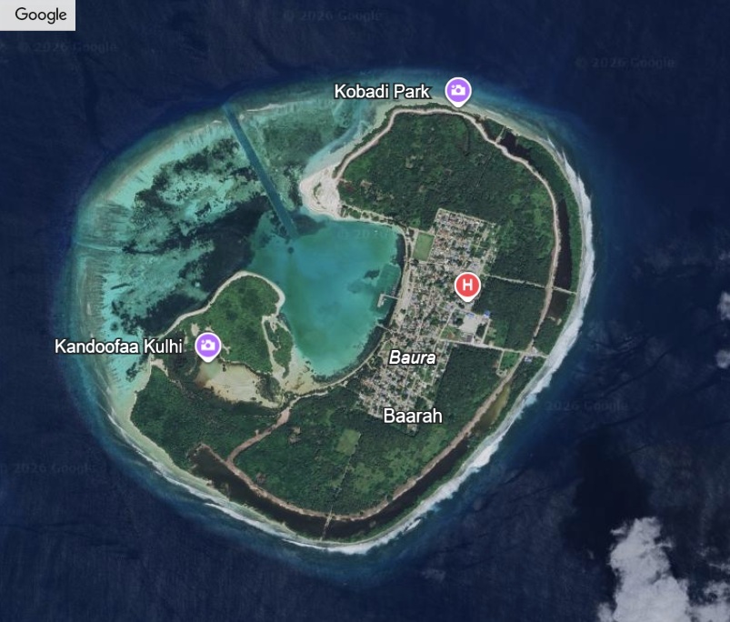
Baarah Mangrove Area
DocumentedMangrove/Wetland
On the eastern side of Baarah, the wetland sits quietly, broken into several mangrove basins that likely once formed a single system. Six mangrove species grow here, including dense stands of kan’doo and ran’doo, holding soil that would otherwise wash away. These waters are not empty—they shelter juvenile fish, rays, and even young sharks moving between lagoon and reef. Elders still recall that this area was part of the route taken by Boduthakurufaanu while evading the Portuguese, giving it a place in national memory. Today, the wetland remains less about scenery and more about survival—of species, shoreline, and story.
Stay in Baarah
Discover the perfect establishment for your island getaway

Quick Stats
- Sites
- 1
- Zones
- 1
- Plots
- 1
- Accommodations
- 1
- Total Beds
- 8